


Southwest: Fulton
Posted by Realtor David Olson 952.314.9446
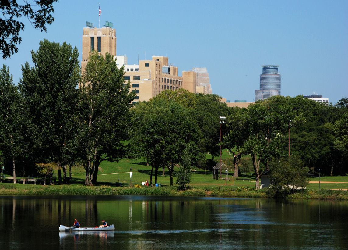
Fulton is in the Southwest community of Minneapolis and it borders the suburb of Edina. It’s bordered on the north by 47th Street West, on the east by Penn Avenue South, on the south by 54th Street West, and on the west by France Avenue South. The beautiful Lake Harriet rests in Fulton’s northeast corner… Read more »
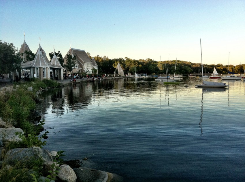
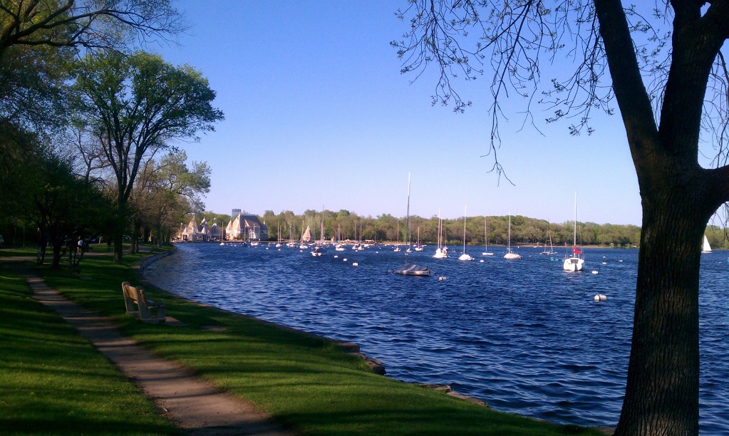
Southwest: East Harriet
Posted by Realtor David Olson 952.314.9446
The East Harriet neighborhood is positioned in Minneapolis’ Southwest community. It derives its name from Lake Harriet, which Fort Snelling constructor Col. Henry Leavenworth named after his own wife. The neighborhood is bounded by 36th Street on the north and 46 th Street to the south. Lyndale Avenue is the eastern border and Lake Harriet… Read more »

Southwest: Armatage
Posted by Realtor David Olson 952.314.9446
Located in the Southwest community of Minneapolis, the Armatage neighborhood is bordered on the north by 54th Street West, on the east by Logan Avenue South, and on the south and west by Highway 62 and Xerxes Avenue South. The neighborhood’s development flourished around the local school which derived its name from Maude Armatage, an illustrious… Read more »
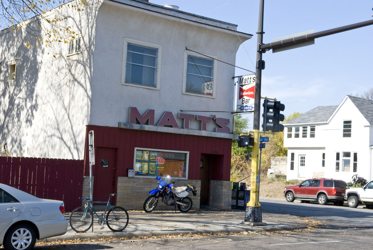
Powderhorn: Whittier
Posted by Realtor David Olson 952.314.9446
Whittier, in Minneapolis’ Powderhorn community, is bordered on the north by Franklin Avenue East and Franklin Ave West, on the east by I-35W, on the south by Lake Street West, and on the west by Lyndale Avenue South. It is one of the city’s first-born neighborhoods, having been initially established in the 19th century, and… Read more »

Powderhorn: Standish
Posted by Realtor David Olson 952.314.9446
Standish is located within the Powderhorn community in Minneapolis. This neighborhood was named after an area elementary school, which had been called Miles Standish after a work by the poet Henry Wadsworth Longfellow. It was considered the outskirts of the city until immigrants, mainly Swedish and Norwegian, started developing housing here in the early 1900’s…. Read more »
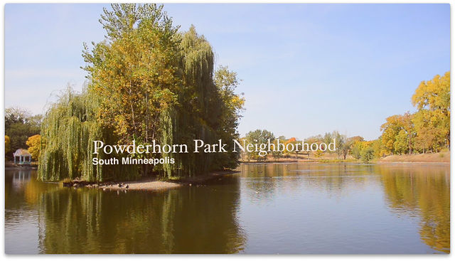
Powderhorn: Powderhorn Park
Posted by Realtor David Olson 952.314.9446
Powderhorn Park, within Minneapolis’ Powderhorn community, got its name from Powderhorn Park Lake, a small lake formed like a powder horn. People congregate for cultural events and community activities in the park and by the lake. The neighborhood is bordered on the north by Lake Street, on the east by Cedar Avenue South, on the… Read more »
Powderhorn: Lyndale
Posted by Realtor David Olson 952.314.9446
Lyndale, located in the Powderhorn community of Minneapolis, is bordered on the north by Lake Street, on the east by Interstate 35W and Stevens Avenue, on the south by 36th Street, and on the west by Lyndale Avenue South. The neighborhood got its name from Lyndale Avenue, which derives its own name from Lyndale farm,… Read more »
Powderhorn: Central
Posted by Realtor David Olson 952.314.9446
The Central neighborhood was named after Minneapolis’s former Central High School, which was one of the city’s largest schools before it was closed in 1982. The neighborhood is bounded by Lake Street on the north and 38th Street on the south. Interstate 35W is the western border and Chicago Avenue is the eastern border. This residential… Read more »
Powderhorn: Corcoran
Posted by Realtor David Olson 952.314.9446
Corcoran, located within the Powderhorn community, is amid Lake Street East and 36th Street East and also Cedar Avenue South and Hiawatha Avenue. The appointed name is in honor of William Wilson Corcoran, who founded the Corcoran Gallery of Art in Washington D.C. This is largely a residential neighborhood, with more than half of the… Read more »
Powderhorn: Bryant
Posted by Realtor David Olson 952.314.9446
Bryant is in south Minneapolis, within the Powderhorn community and is bordered on the north by 38th Street East, on the west by Interstate 35W, on the south by 42nd Street East and on the east by Chicago Avenue. The neighborhood derived its name from William Cullen Bryant, a famous American poet who lived from… Read more »
Powderhorn: Bancroft
Posted by Realtor David Olson 952.314.9446
The Bancroft neighborhood is situated south of Powderhorn Lake, between 38th Street East to the north and 42nd Street East to the south, and amid Chicago Avenue on the west and Cedar Avenue on the southeast side of the Powderhorn Community in Minneapolis. The neighborhood got its name from the Bancroft Elementary School, which was… Read more »
Phillips: Ventura Village
Posted by Realtor David Olson 952.314.9446
The Ventura Village neighborhood, located south of downtown Minneapolis, used to be a part of the Phillips neighborhood. It became a separate neighborhood in 2002 when the Minneapolis City Council accepted its proposed boundaries. However, it is still a part of the larger Phillips community. Interstate 35 occupies the western and northern boundaries, with Interstate 94… Read more »

Phillips: Phillips West
Posted by Realtor David Olson 952.314.9446
The Phillips West neighborhood, located within the Phillips community, is positioned south of downtown Minneapolis. The neighborhood and its junior high school derive their names from Wendell Phillips, a 19th-century abolitionist. Phillips West is a diverse neighborhood with its population of close to 5,000 residents including people of many nationalities. The neighborhood has a mix… Read more »

Phillips: Midtown Phillips
Posted by Realtor David Olson 952.314.9446
The Midtown Phillips neighborhood, located within the Phillips community, is found in south Minneapolis. Both the neighborhood and its junior high school get their names from Wendell Phillips, a 19th-century abolitionist. Midtown Phillips is a distinct neighborhood with its population of close to 4,500 residents, including many that are of different ethnic races. The neighborhood… Read more »
Northeast: Windom Park
Posted by Realtor David Olson 952.314.9446
Windom Park is in the Northeast community of Minneapolis, and its geographical location is exactly what the community name suggests. Lowry Avenue NE borders the neighborhood on the north on the west by Central Avenue NE, on the south by 18th Avenue NE and on the east by New Brighton Boulevard. The name for the… Read more »