


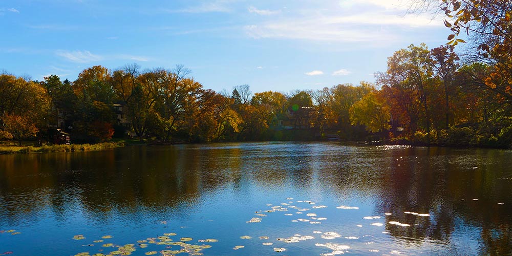
Northeast Edina: Sunny Slope
Posted by Realtor David Olson 952.314.9446
With a population of 200 residents, Sunny Slope is situated in the Northwest quadrant of the city of Edina. It is bounded on the north and east by the wandering Minnehaha Creek, on the south by 50th St, and on the west by Highway 100. Of its 360 homes, most were built in the 1960’s… Read more »
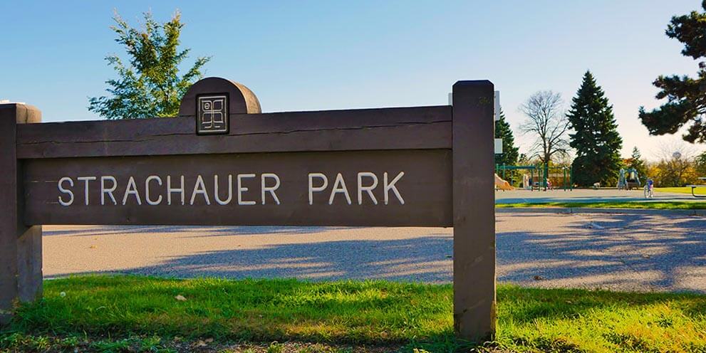
Northeast Edina: Strachauer Park
Posted by Realtor David Olson 952.314.9446
With a population of 800 residents, the Strachauer Park neighborhood is situated in the Northeast quadrant of the city of Edina. It is bordered by 60th Street to the north, Xerxes Avenue to the east, Highway 62 to the south, and France Avenue to the west. This mainly residential neighborhood was established as three subdivisions,… Read more »
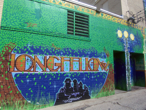
Longfellow: Longfellow
Posted by Realtor David Olson 952.314.9446
The Longfellow neighborhood is the source of the greater Longfellow community’s name. Named after Henry Wadsworth Longfellow, a renowned American poet who documented much of the surrounding area in his poetic works, the Longfellow neighborhood has been a long-standing component of the city of Minneapolis. The Longfellow neighborhood is one of five neighborhoods located within… Read more »
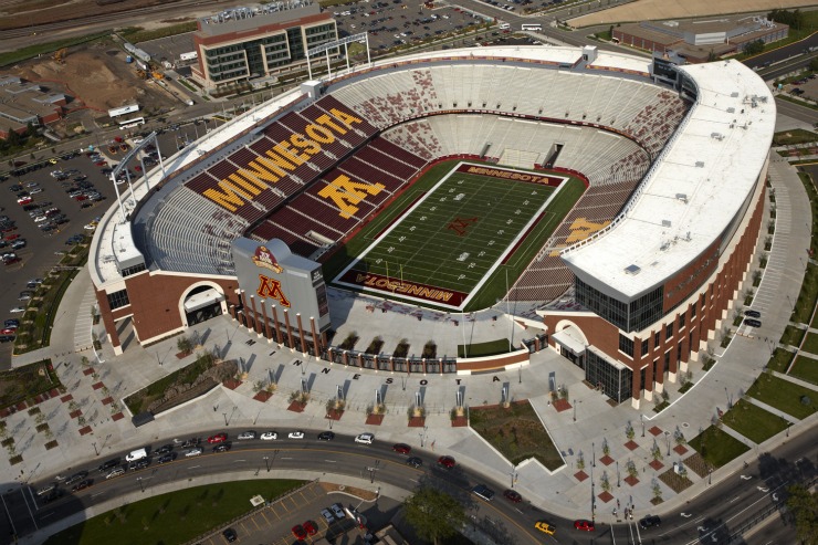
University: University
Posted by Realtor David Olson 952.314.9446
Home to around 6,000 residents, the University neighborhood is located east of downtown Minneapolis. The Mississippi River divides the neighborhood into the west bank and the east bank. The neighborhood is almost entirely occupied by the University of Minnesota, hence its name, University. The University of Minnesota is one of the top public universities in… Read more »

University: Prospect Park
Posted by Realtor David Olson 952.314.9446
Prospect Park is situated in east central Minneapolis and within the University community. The neighborhood borders the City of Saint Paul on the eastern side and the University of Minnesota on the west side. It is also bordered on the south by the Mississippi River and on the north by the railroad tracks. The neighborhood was… Read more »
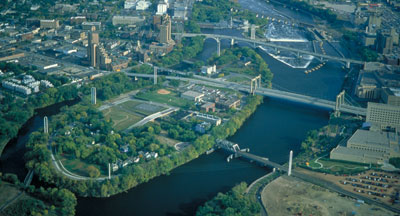
University: Nicollet Island/East Bank
Posted by Realtor David Olson 952.314.9446
The Nicollet Island/East Bank neighborhood contains a small residential population of 1,500 and Nicollet Island on the Mississippi River just east of downtown Minneapolis as well as a share of the eastern riverbank located between Central Avenue and the Burlington Northern Santa Fe Railroad line. The neighborhood is the geographical center of Minneapolis. The island… Read more »
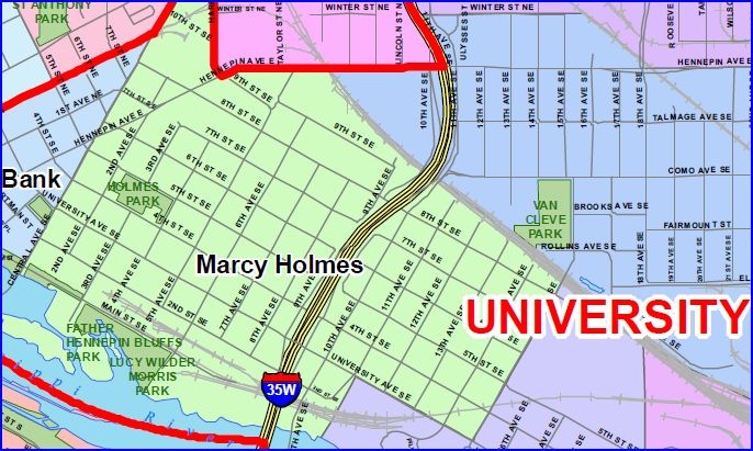
University: Marcy-Holmes
Posted by Realtor David Olson 952.314.9446
The city’s “first neighborhood” is now one of its finest. The Marcy-Holmes neighborhood, situated on the east bank of the Mississippi River in the University Community, got its name from William L. Marcy, an American statesman and secretary of state born in 1786 along with Oliver Wendell Holmes, an American poet, author, and novelist who… Read more »
University: Como
Posted by Realtor David Olson 952.314.9446
Como, which is also commonly referred to as Southeast Como, is named after Como Avenue, which travels along the neighborhood. Como Avenue took its name from Lake Como in northern Italy, a prevalent tourist objective. Como neighborhood is in the University community, just north of the Dinkytown area and the east bank campus of the… Read more »
University: Cedar-Riverside
Posted by Realtor David Olson 952.314.9446
Cedar-Riverside, located in the University community, is named after the intersection of the two main avenues of the neighborhood, which are Cedar and Riverside. The neighborhood is triangular-shaped with three ultimate boundaries. The Mississippi River is on the east side, Interstate 94 on the south side, and Interstate 35W on the west side. Cedar-Riverside is… Read more »
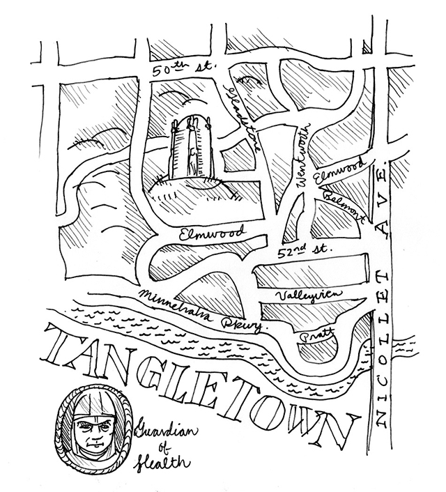
Southwest: Tangletown
Posted by Realtor David Olson 952.314.9446
The Tangletown neighborhood, located in the Southwest community of Minneapolis, is bordered on the north by 46th Street, on the east by Interstate 35W, on the south by 54th Street and Diamond Lake Road, and on the west by Lyndale Avenue South. Minnehaha Creek travels through the southern portion of the neighborhood. The name Tangletown… Read more »
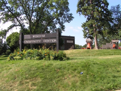
Southwest: Windom
Posted by Realtor David Olson 952.314.9446
The Windom neighborhood is located in the Southwest community of Minneapolis. Lyndale Avenue S, Highway 121, Diamond Lake Road, 54th St W, Interstate 35W and Highway 62 border the neighborhood. Both the Windom neighborhood and its elementary school were named after William Windom. He served in the 1800’s as a United States senator from Minnesota… Read more »
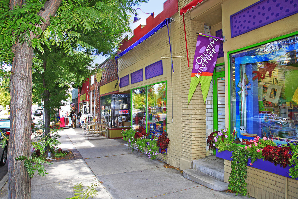
Southwest: Lynnhurst
Posted by Realtor David Olson 952.314.9446
The Lynnhurst neighborhood is located in the Minneapolis Southwest community and near the southern end of Lake Harriet. Minnehaha Creek runs through the north and south ends, dividing the neighborhood. Lynnhurst ranges from Lyndale Avenue to Penn Avenue and from 46th Street to 54th Street. It derives its name from a neighborhood park, which was… Read more »
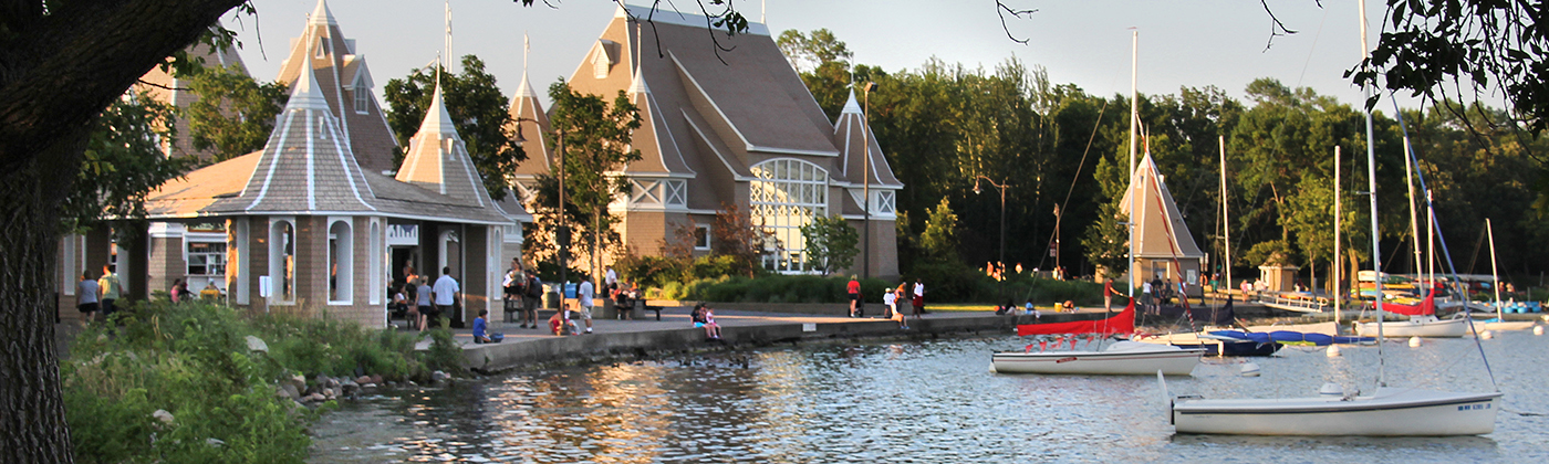
Southwest: Linden Hills
Posted by Realtor David Olson 952.314.9446
Linden Hills is located in the Southwest community of Minneapolis. It’s bordered on the north by 36th Street West and Lake Calhoun, on the east by William Berry Drive and Lake Harriet, on the south by 47th Street West, and on the west by France Avenue. Linden Hills is one of the most unique neighborhoods… Read more »

Southwest: King Field
Posted by Realtor David Olson 952.314.9446
The King Field neighborhood was named after Colonel William S. King, who was an ex-congressman and a noteworthy figure in national matters. He lived in Minneapolis in the 19th century and was effective in the anti-slavery issue. The neighborhood named after him is situated in Minneapolis’ Southwest community and borders Interstate 35W on the east… Read more »
Southwest: Kenny
Posted by Realtor David Olson 952.314.9446
The Kenny neighborhood is located in Southwest Community Minneapolis. Highway 62, 54th Street, Lyndale Avenue border the neighborhood on the east, and Logan Avenue South on the west. The neighborhood, its park and its elementary school all derived their shared name for Sister Elizabeth Kenny, an Australian nurse who established the Kenny practice of treating… Read more »